Hi.
After a winter on land we’re back on the water.
Please join us at Choisiadventures.wordpress.com
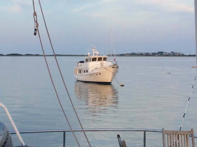
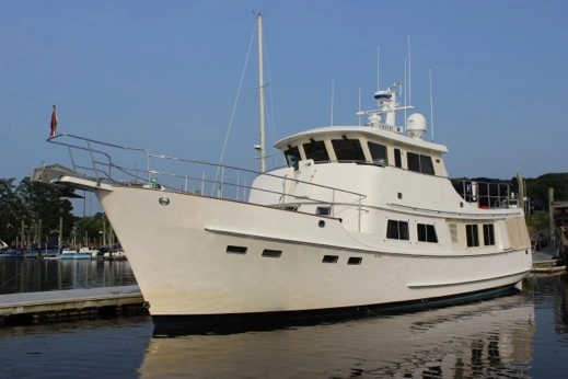
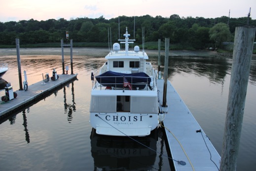
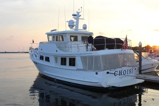
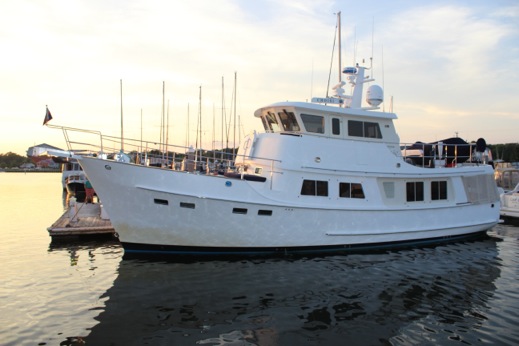
M/V Choisi — Kadey Krogen 55' Adventure
Hi.
After a winter on land we’re back on the water.
Please join us at Choisiadventures.wordpress.com
HI. This summer we’re doing a relatively short cruise to Nova Scotia & Maine. If you’d like to follow us. please check out:
http://www.choisiadventures.wordpress.com
We finished our Alaska-to-Maine Adventure last August and spent the winter in Dartmouth, MA. We’re off again. If you’d like to continue following our Adventures follow us at:
Choisiadventures.wordpress.com
Thanks for all you interest and support as we made it all the way from Alaska to Maine & back home again.
Sara, Peter, Charlotte, Frances & Leo.
The WordPress.com stats helper monkeys prepared a 2015 annual report for this blog.

Here’s an excerpt:
A New York City subway train holds 1,200 people. This blog was viewed about 4,400 times in 2015. If it were a NYC subway train, it would take about 4 trips to carry that many people.
Leg #24 — The End of the Big U Adventure:
425 Days from Juneau, Alaska to Belfast, Maine.
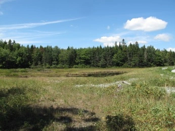
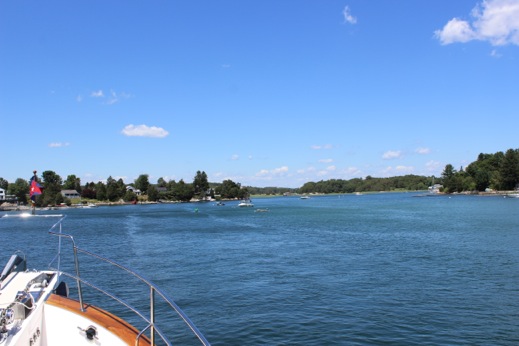
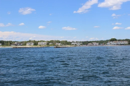
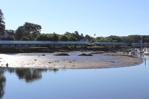
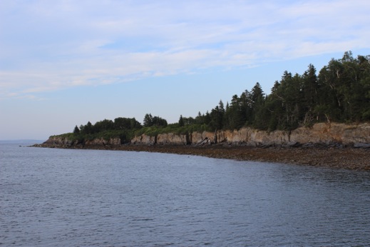
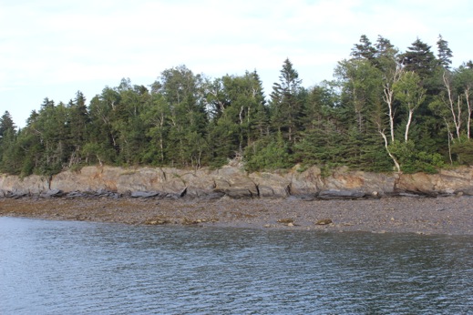
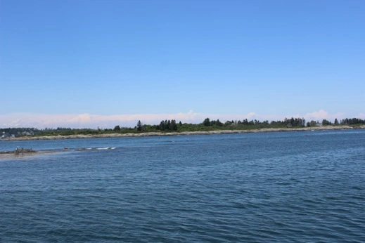
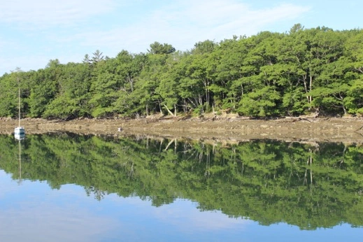
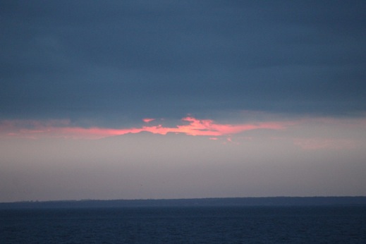
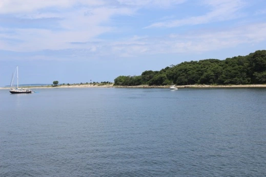
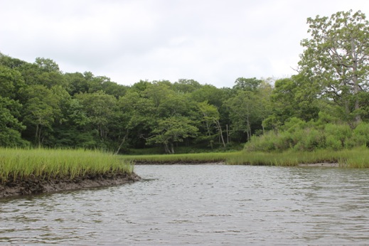
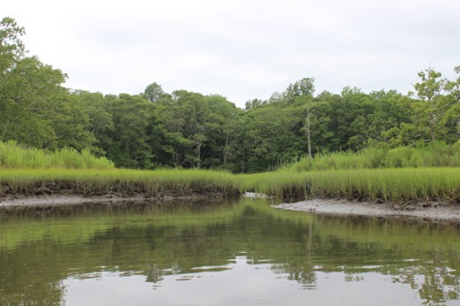
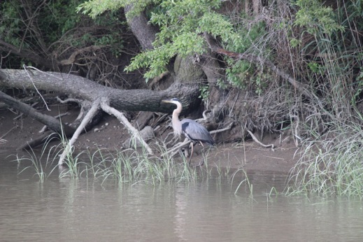
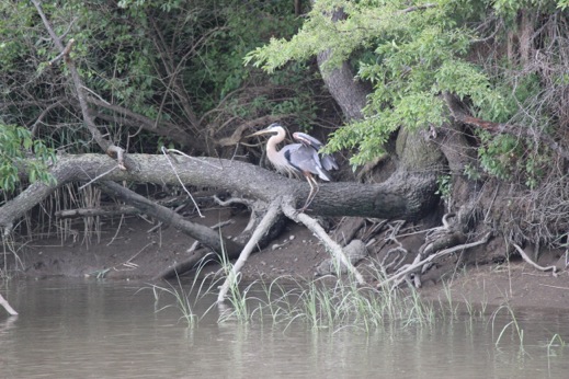
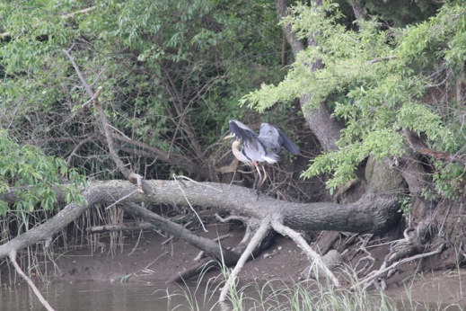
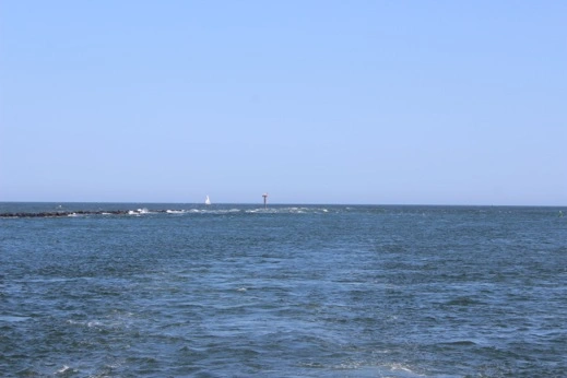
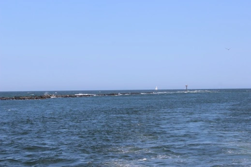
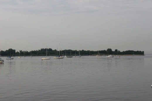
Day 418 August 6, 2015 Maple Juice Cove, ME 43 58 56 N 69 16 81 W (3.4 h) At Anchor
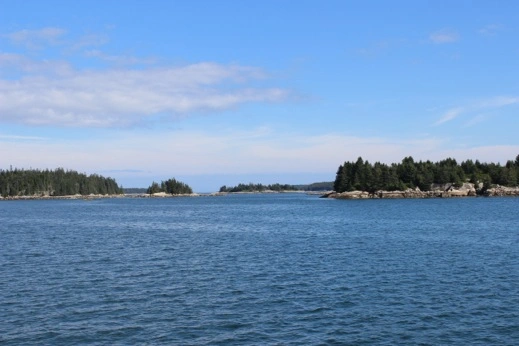
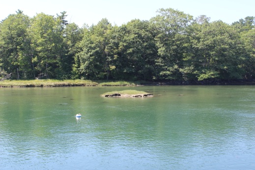
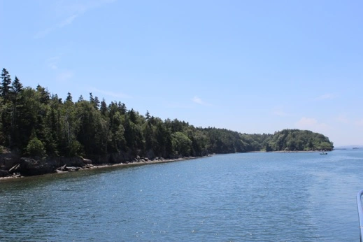
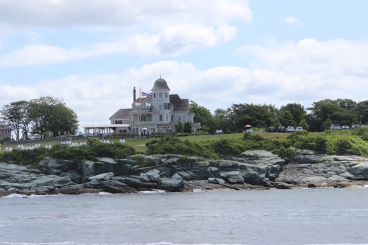
We headed out into Sheepscot Bay and down around Southport Island into Booth Bay. A beautiful & peaceful morning & except for the lobster boats we were pretty much on our own. We took JJ & Jill’s advice and headed towards Maple Juice Cove which is up the St. George River on Muscongus Bay. We pulled into the anchorage and found a couple of sailboats already enjoying the peaceful anchorage & set our hook. The scenery looked just like a Wyeth painting which makes sense since this is where the 3 generations of painters lived. It was a lovely place for Peter & I to spend our last solo night aboard. This odyssey has been incredible accomplishment but tonight was a little sad too as it means the end of the journey is in sight.
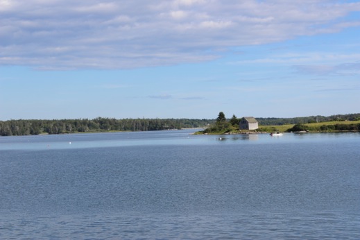
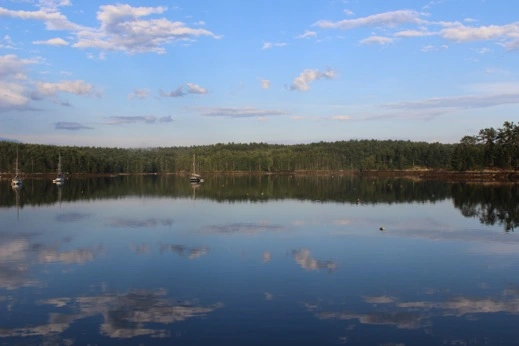
Stones Point: St. George River, Muscongus Bay
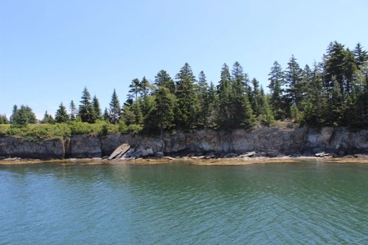
Maple Juice Cove: St. George River
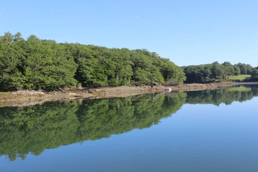
Maple Juice Cove: A lovely house on the point.
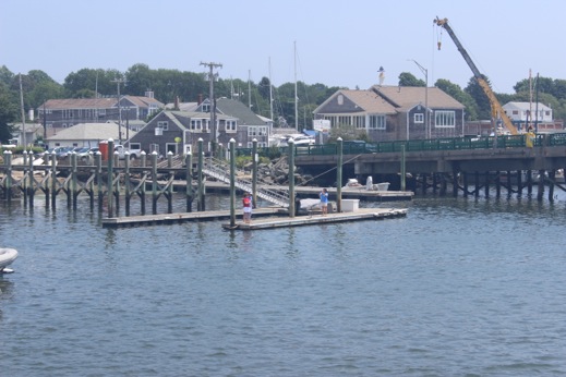
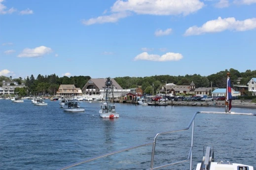
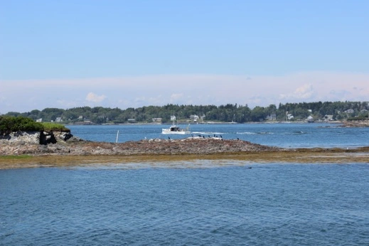
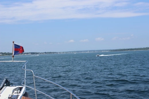
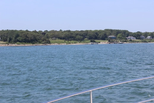
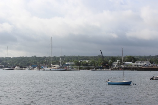
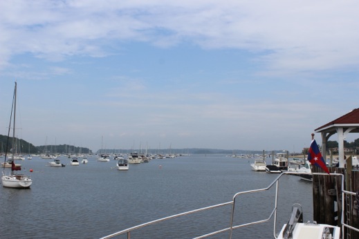
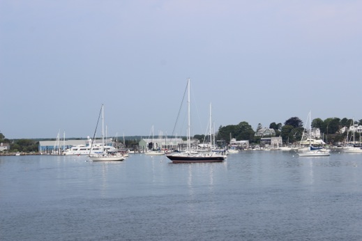
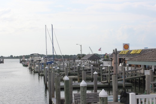
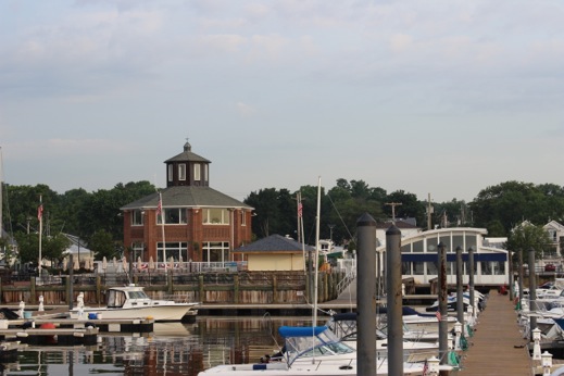
Day 419 August 7, 2015 Rockland, ME 44 06 08 N 69 06 29 W (5.4 h) Landings Marina
Another beautiful day in paradise. We puttered out of Maple Juice Cove and headed down the St. George River and out around Hupper Island & Mosquito Island into Two Bush Channel. When I put our course in I overshot Muscle Ridge Channel and took us out further into the main channel leading into Penobscot Bay. While Muscle Ridge is very pretty it’s also chock full of lobster pots and by going further out we were in deeper & clearer water. We took on fuel at The Journey’s End where the NYYC was based (rafted 3 deep) & then we moved onto our dock at The Landings which was a great spot for a couple of days. Jeffrey & DeAnna arrived from MA & we had a nice dinner ashore & our first episode of Elementary.
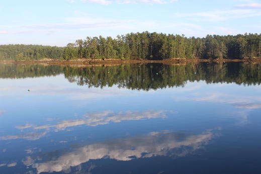
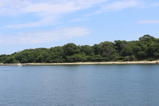
Morning light on Maple Juice Cove: St. George River
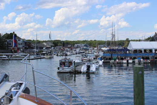
Day 420 August 8, 2015 Layday Rockland ME
Another rain-free day in Maine. We went to the Wyeth Center at the Farnsworth Art Museum & saw the 3 generations of Wyeth art; 3 completely different styles but the Maine watercolors are beautiful. We took advantage of the Honda’s arrival and provisioned for the coming week & re-filled one of the propane tanks. When we got back to the dock the M/V Quineska pulled in — an Outer Reef 68’. The challenge: Where have we seen her before? We tried to figure it out but finally resorted to the business card folder; we last saw her in Charleston, SC at the Harborage at Ashley. Mystery solved. We walked over to the NYYC informational briefing & opening reception at The Journey’s End which was a really nice party. Lots of shrimp, mussels & tid bits so no need to make dinner when we got back. Elementary.
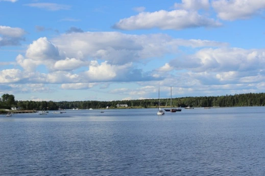
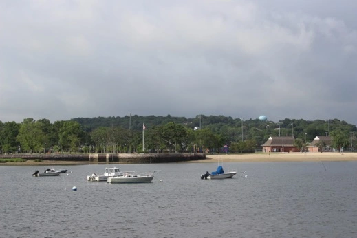
Day 421 August 9, 2015 Billings Cove: Southeast Harbor, ME 44 11 95 N 68 35 77 W (4.4 h) At Anchor
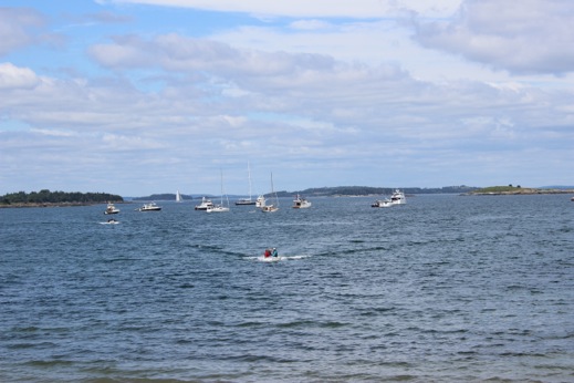
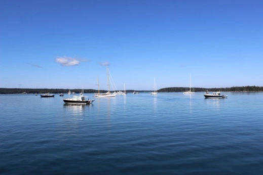
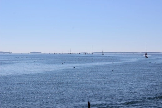
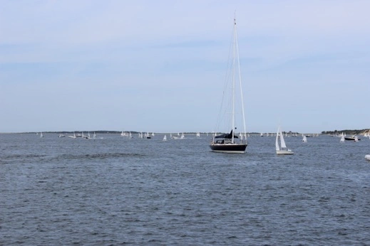
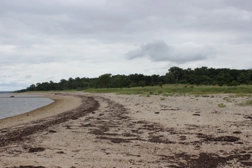
This morning was a little more like a typical Maine morning — slightly overcast but a promise of sun in the afternoon. We went out to the starting area for both the racing boats and the predicted log race. We waited for the sailboats to take off and head north while we took off and headed NE to the north side of North Haven Island. The predicted log course was roughly 12 miles which we predicted we would finish in 91 min:26 secs and we finished 1 minute 28 seconds off our predicted time. We miscalculated the effect of the tide. We tried to turn our results in but couldn’t raise the Fleet Captain so we tried to submit online but god only knows if that email went through so we’ll have to see how we did on our first predicted log attempt. After we finished we met up with the Cruise in Company boats at Mullen Cove & went ashore for a walk at a property overseen by the North Haven Conservation Partners. This was the first time the NYYC has organized a mid day rendezvous for non racing vessels and it was nice to see a good turnout. A very pretty walk along the shoreline & always good to stretch a bit. We hauled anchor and crossed over East Penobscot Bay to Deer Island Thorofare and past Stonington, ME. Jeffrey was impressed by the sheer amount of granite that just tumbles down to the water’s edge everywhere. We passed by Devil Island (a favorite spot with our J boat) & headed north up towards Southeast Harbor. The NYYC had contacted the local lobstermen & told them we were coming in for a night & asked them if they could clear an area so we wouldn’t foul their lobster pots. They agreed to clear a part of Billings Cove which they don’t use too much because it has a muddy bottom which the lobsters don’t like. That worked out great for us because our anchors like mud best so it all worked out. All 90 of the boats easily fit in the cove and it was a quiet night. Another Elementary.
Leaving Rockland, ME & heading to the starting line for the Predicted Log Race #1
The Cruise in Company Fleet at Mullen’s Head.
Cruise in Company fleet anchored off of Mullen Head for the walk at the MCHT Preserve
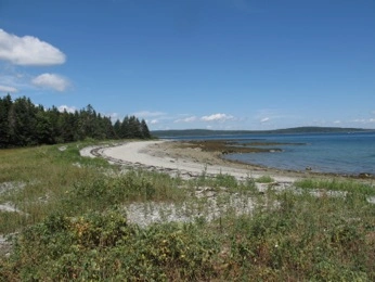
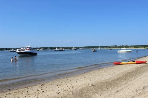
The Beach at Mullen Cove
View of East Penobscot Bay: Across Burnt Island & Calderwood Island
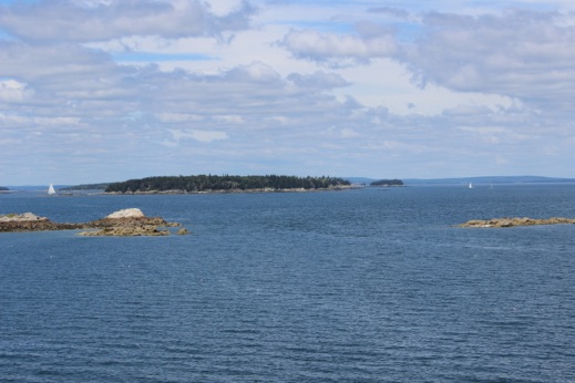
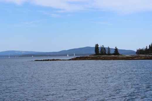
East Penobscot Bay: Isle Au Haut in the background
Mullen Cove: The C in C Fleet
Peter & Jeffrey on our March About
Jeffrey & DeAnna: It was a blue shirt day for racing.
View of Devil Island from the Deer Island Thorofare.
Billings Cove: Southeast Harbor, ME
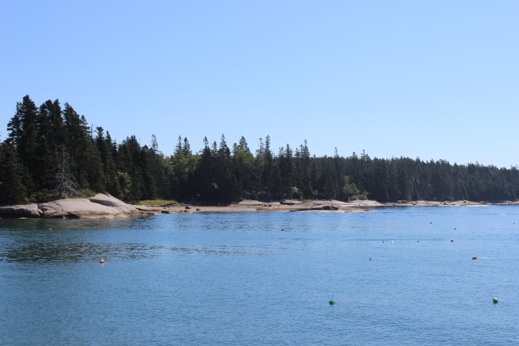
Day 422 August 10, 2015 Pretty Marsh, ME 44 20 15 N 68 24 77 W (3.1 h) At Anchor
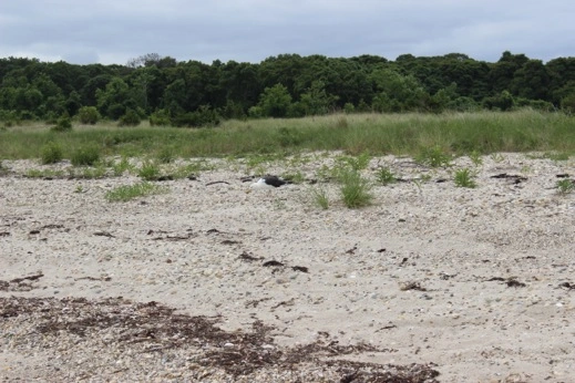
There isn’t a predicted log race today so we’re just heading out with the fleet and north up Blue Hill Bay. The C in C Fleet anchored in Allen Cove off of Harriman Point for another walk led by a MCHT representative who was guiding us around one of their newest preserves which had been gifted in January of 2015. The land was a gift from a family who used the property for hunting birds so it’s really very undisturbed and in good shape. DeAnna & I kayaked ashore and we had a nice group walk over to the beach & then DeAnna and I walked the length of the property while the boys went back to Choisi. We motored across Blue Hill Bay to Pretty Marsh Harbor and tucked in behind West Point. We invited Quineska aboard for cocktails & quickly decided to sit inside as it was getting pretty chilly on the back deck. Peter shared The Lone Ranger with DeAnna & Jeffrey.
Jeffrey doing Will’s morning duty: raising the anchor in Billings Cove.
Fleet getting underway
Fleet heading south out of Blue Hill Bay — just a few lobster pots — with toggles!
Mount Desert in the background. Just cruising down the Bay.
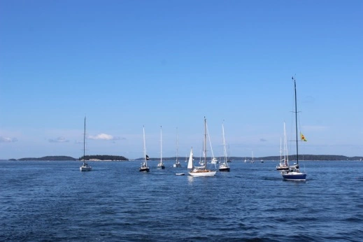
The racing fleet on its way to the start
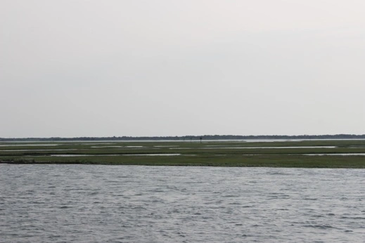
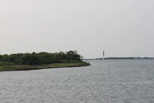
The lighthouse at Green Island as we left Blue Hill Bay & we went into Jericho Bay.
Mount Desert on Mt. Desert Island
Coming into Allen Cove at Harriman Point
DeAnna in her pedal kayak
The newest conservation acquisition for the MCHT at Harriman Point.
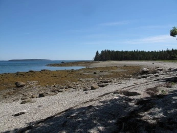
The beach at Harriman Point
Harrimon Point: Blue Hill Bay
Choisi at anchor: Allen Cove
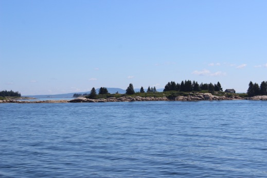
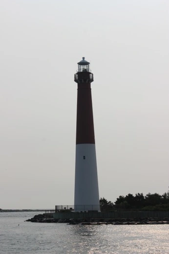
Day 423 August 11, 2015 Bucks Harbor, ME 44 20 08 N 68 43 95 W (3.3 h) At Anchor
We crossed back over Blue Hill Bay through Jericho Bay to Eggemonggin Reach for Predicted Log #2 run up the Reach. It was overcast but there was still good visibility and we think we did well. We miscalculated the amount of ebbing tide so if we were off it was because we were going too fast. We’ll have to wait for the race results. We anchored in Bucks Harbor just in the lee of Grays Point. We were exposed to SW but ok for SE. The catamaran Flow was right off our bow and we had lots of company! It was a rainy afternoon and we were very happy to be warm & dry in the main salon. The wind picked up to 18 – 25 knots & there was a slight chop in the anchorage but the anchor held without any issues. It was last dinner aboard for the 4 of us & I’ll miss saying Grace aboard the M/V Choisi. Double episode of Elementary.
Fleet underway leaving Billings Cove
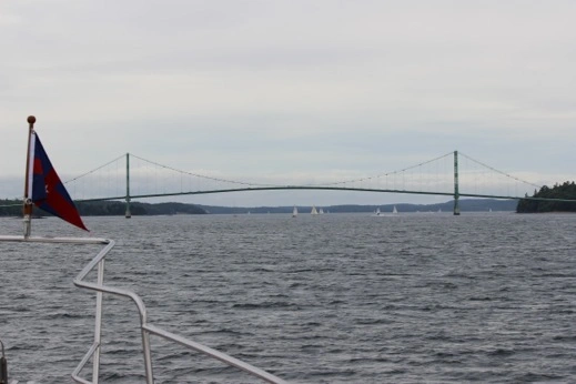
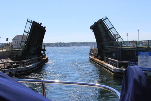
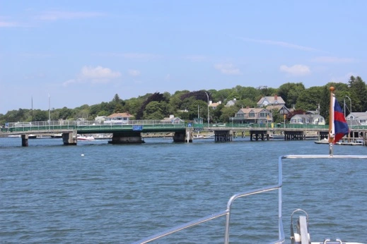
The Little Deer Island bridge
Day 424 August 12, 2015 Belfast, ME 47 25 75 N 69 00 33 W (3.6 h) Front Street Shipyard
We awoke to our first real foggy Maine morning. The boats in the anchorage faded in and out as the fog blew through the fleet. A special morning spectacle. The wind was very light out of the SW so the racing fleet had a delayed start and we headed out for the Cruise in Company rendezvous at Holbrook Island. We visited aboard Picasso before DeAnna & I headed to shore to have a walk-a-bout. After saying good-bye to the seals lounging on the rocks in the cove we motored across the top of Islesboro Island we caught up with the racing fleet who was limping towards the finish line in very light winds. I certainly don’t miss those days. We were able to get a spot at Front Street Shipyard so we’re all plugged in and the generator can take a break. We gathered with the Fleet at the Steamship Landing and had a nice time at the Officers’ Cocktail Party before heading back to Choisi and, you guessed it, an episode of Elementary.
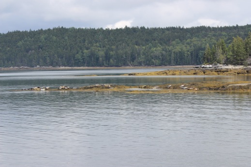
Seals on the rocks as we came around the point at Holbrook Island.
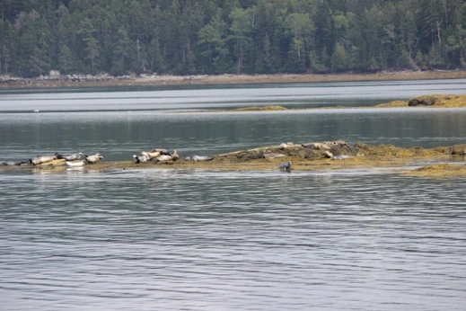
The seals on the rocks that were exposed as the tide ebbed.
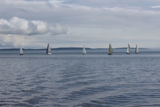
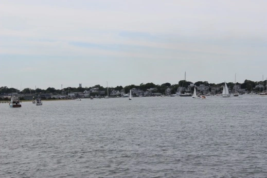
The racing fleet approaching the finish line at the head of Islesboro Island
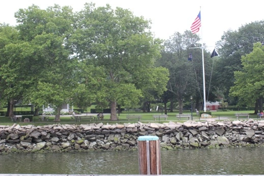
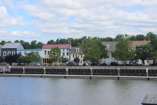
Day 425 August 13, 2015 Layday Belfast, ME
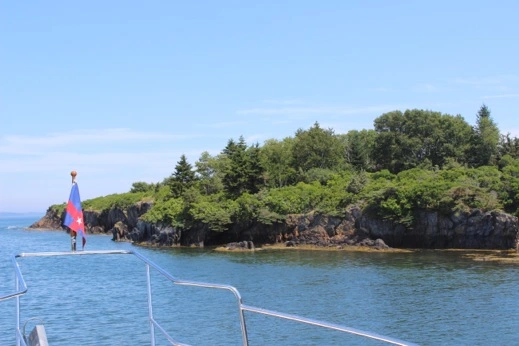
A beautiful sunny day with hardly a breeze. All the fleet have “dressed ship” which means that all the boats have their signal flags up. The sailboats have the flags going from the top of the mast to the bow & stern and the power boats string their flags from bow to stern as well. It’s always a treat to see so many boats all dressed to celebrate a layday in port. DeAnna & I will hike up the hill to find Hannafords to provision for the trip south & I’ll get ready to take off tomorrow to head to the Berkshires to spend Mom’s Weekend at Chimney Corners Camp with Charlotte & Frances. I’ll meet up with Choisi when she comes through the Padanaram swing bridge on Monday August 17th. This is the furthest north we’ll get on the Atlantic side of the States & as far as I go on this Adventure. It’s been an incredible year and one we’ll never forget or stop talking about. A big kuddo to Choisi for getting us safely from one side of the country to the other. It’s been an amazing trip.
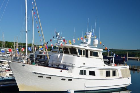
Choisi at Front Street Shipyard: “dressed”

Some of the fleet at Front Street Shipyard on the cruise’s layday in Belfast, ME
August 1, 2015: 413 Days — 11,779 NM from Juneau, AK to Kennebunkport, ME. We did it!
Day 409 July 28, 2015 Duxbury, MA 42 00 88 N 70 37 93 W (6 h)
Private mooring
With Charlotte & Frances safely ensconced at Chimney it was time to hit the high seas again. We have nine days to get north to Rockland, ME where we’ll meet up with Jeffrey & DeAnna for the NYYC summer cruise in Penobscot Bay. Today the Cape Cod Canal starts to ebb east at 1400 so we’ll head up Buzzards Bay & catch a ride through the canal.
Peter waiting for the bridge opening at 1300. We waited for an incoming tide so we’d have better control of the boat going through the bridge.
The dock at the Yellow House. DeAnna, Debby and the rest of us were nervous we’d bump going out.
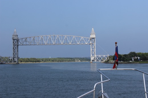
The railroad bridge across the Cape Cod Canal. A calm passage through and 2 – 3 knots of current pushing us along.
Exiting the Cape Cod Canal. There was a low fog bank and the current was still ebbing.
The lighthouse as we entered Duxbury Bay.
A lovely calm night & we lucked out and scored a guest mooring courtesy of John aboard Raven.
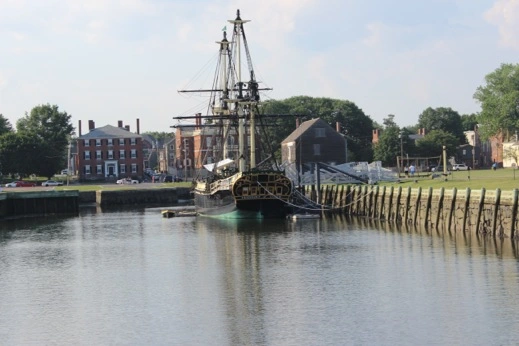
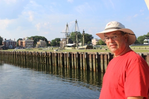
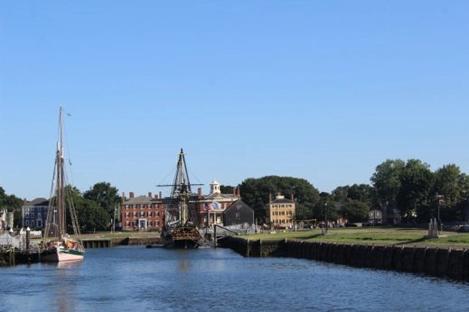
Day 410 July 29, 2015 Salem, MA 42 31 15 N 70 53 29 W (7.6 h)
Pickering Wharf Marina
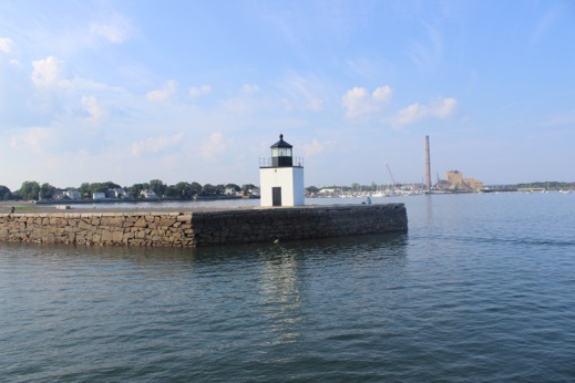
The lighthouse at the approach to the inner harbor in Salem. First attempt at Brewars next to the smoke stack didn’t work out; not enough frontage.
The old dry-docks & wharf in Salem. We seem to always come in at low tide!
1.9 feet of water under us as we came into Salem.
One of the old schooners moored across from the Customs House in Salem, MA.
Peter wondering why we always come in at low tide?
Tied up at Pickering Wharf right in town — a great dock and much better location than Brewars. Dinner ashore at Finz by the wharf.
Day 411 July 30, 2015 Layday Salem, MA
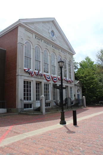
I had never been to Salem & Peter came to visit the first time when he was 13 so time to check it out again. We started at the Essex Museum and admired their early American collections and then toured three restored historic homes they moved onto their property to save them from demolition.
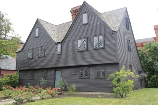
The John Ward house circa 1684. Original house was on the left side of the door. They added to second 1/2 as Ward became more prosperous as a leather craftsman & to accommodate their 7 children.
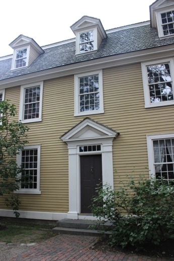
The Crowninsheild-Bentley House, circa 1727, an example of Georgian Colonial architecture.
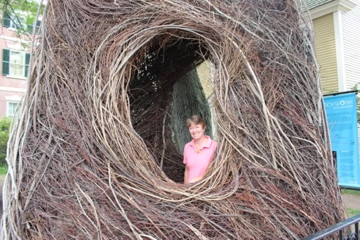
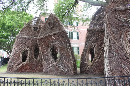
“What the Birds Know” — a “stickwork” by Patrick Dougherty built in May 2015. One of 260 stickworks he’s done in North America, Europe & Asia.
Thousands of woven saplings which produce “a visual effect similar to a drawing, with each sapling representing an individual line”. Different.
The old part of the Salem Essex Museum. The new wing houses a great collection of Early American & Maritime Art.
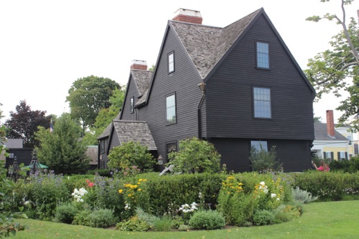
The House of the Seven Gables: The house was built in 1668 for Captain John Turner. It was made famous by Nathaniel Hawthorne’s book of the same name. HIs cousin Susan Ingersoll inherited the house from her father, Samuel Ingersoll, and lived here during the 1800’s. The house was moved to this site in 1958.
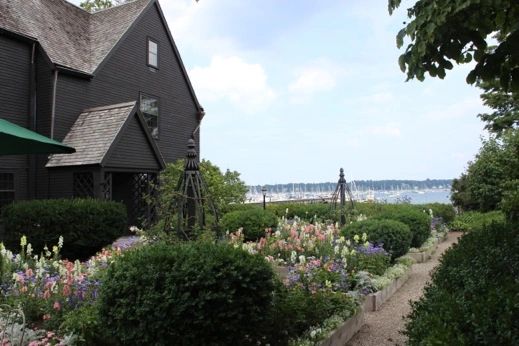
The English Gardens at the House of the Seven Gables
Day 412 July 31, 2015 Newburyport, MA 42 49 00 N 70 52 00 W (5.7 h) Town Mooring
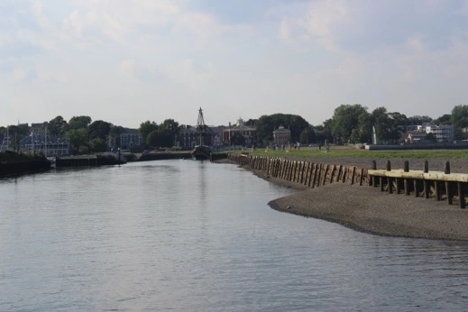
Leaving Salem. Another schooner had come in and it looked like campers were aboard swabbing the decks.
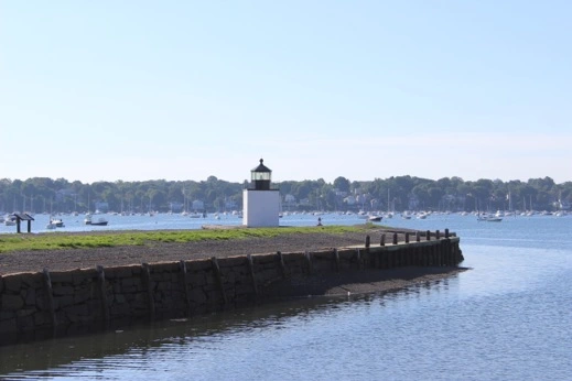
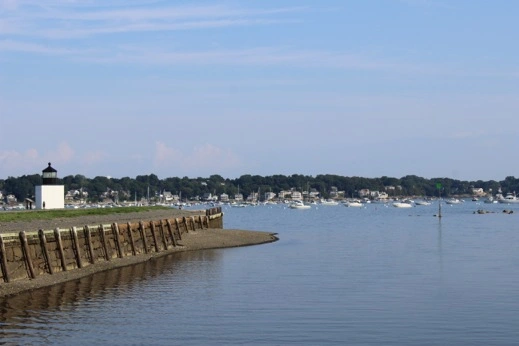
The lighthouse as we were leaving. Tide was coming in at least….
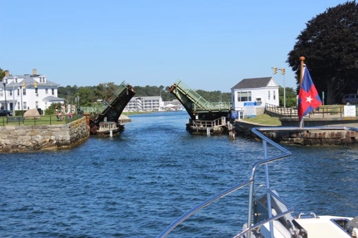
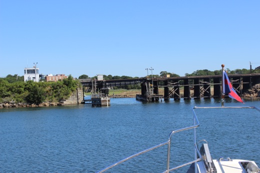
Blyman Bridge: Gloucester, MA. Leading into the Annisquam River.
The bridge master even called us to check out beam. The bridge is reported to be 30’ so not so bad once we got closer & through!
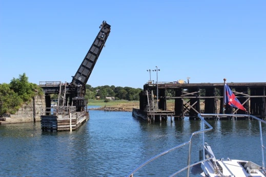
The Metro Railroad bridge on the Annisquam River. Hard turn to port as we went through!
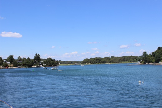
The Annisquam River. A really beautiful area and you’d never know you’re a stone’s throw from Boston. An old community with some awesome houses.
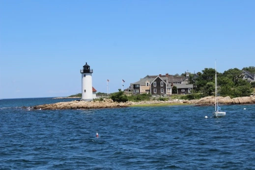
The lighthouse as we left the Annisquam River and headed out into Ipswich Bay & the Atlantic Ocean north of Cape Ann.
We headed up to Newburyport and picked up one of the town moorings off the boardwalk. We decided to head in later so we could do a walk-about and then find a spot for dinner. There was a summer festival going on so the town was full of people, boats, musicians & cars. We wandered about and then saw an old brick building which housed Ceia Kitchen Bar. It looked interesting so we stopped in. We were seated up on the 3rd floor and had an incredible meal made up of 3 appetizers which were an incredible combination of ingredients & flavors. A treat. A little tricky getting our dingy out but we got back before nightfall so all was good.
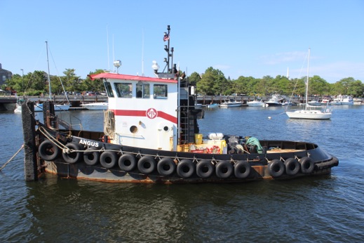
Tugboat Angus: So this is what my brother’s been doing while we’ve been away……
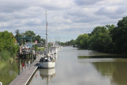
Day 413 August 1, 2015 Kennebunkport, ME 43 21 47 N 70 28 60 W (5.1 h) Arundel Yacht Club **** WE MADE IT TO MAINE!!
The tide was swinging around again and the tugboat Angus got pretty close in Newburyport but at least it had bumpers all the way around. We headed out against the tide and north towards Maine. The wind’s out of the West so the seas are gentle swells and we’re making good time. We’re back in the land of lobster pots so we have to keep an eagle eye out for the ones that blend right into the sea. Fun, Fun, Fun. We tied up at the AYC as guests of Bill & Jane which was a nice treat. We had them over for dinner & had a nice time catching up.
Our first photo underway: courtesy of John aboard Raven who we caught up with off of New Hampshire.
The approach to Kennebunkport, ME
Kennebunkport River & the River Club — one of the oldest yacht clubs in ME. Lots of kids in their sailing program.
View up the river from the Arundel Yacht Club — main part of town is up towards the bridge.
Now this is a low tide!! We woke up & we were listing to port. Luckily it was a soft muddy bottom.
Day 414 August 2, 2015 Layday Kennebunkport, ME
We went over to Cape Porpoise for lunch at Bob & Jane’s and then borrowed their car to provision for the week. Dinner ashore with Bob & Jane.
We waited for the tide to come in before turning around and heading back out to sea. Same little knoll from the previous photo!
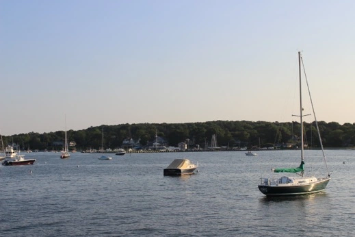
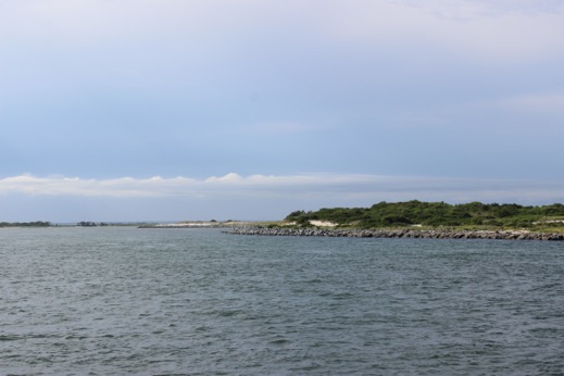
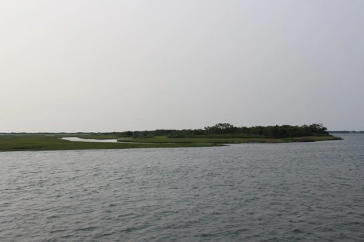
Day 415 August 3, 2015 Jewel Island, ME 43 41 23 N 70 05 49 W (4.1 h) at anchor
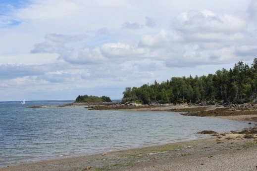
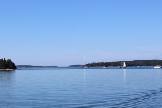
This is one of my favorite spots on Earth. We’ve been coming to Jewel Island every time we’ve sailed south from Maine to New England. Today was the first time that I actually sailed north into Maine so the approach to Jewel Island was different and less confusing as there are fewer rocks coming up from the south; still an insane number of lobster pots that we had to negotiate. We anchored in front of 4 sailboats just off the landing spot to the island on an outgoing tide so as the evening progresses the shale onshore becomes more exposed and the evening light reflects off the gold in the shale. I kayaked ashore and took a hike in the woods and enjoyed the lovely balsam scent and the beauty of the rugged eastern coast.

The anchorage at Jewel Island, ME. One of the prettiest spots on our trip.
Looking north towards the mainland and the tip of the island.
One of the camping sites on the island. The boat is pulled up where we go ashore.
Evening light at Jewel. The rocks face west so as the sun sets the rocks begin to glisten & glow.
Evening light on the rocks. Tide’s going out. At a full moon low tide we only had 1.3’ under our keel.
Looking SW towards Portland, ME across the island. The peninsula to the right is usually not connected to the main island — Very low tide.
Day 416 August 4, 2015 The Basin, Sebasco, ME 43 48 33 N 69 51 35 W
(2.3 h) at anchor
Morning walk: a view of the Punch Bowl. East side of Jewel.
A view East. Usually the waves are crashing over these rocks into the pool. Calm & foggy morning.
The Punch Bowl. Tide still going out.
View from The Tower: A WWII lookout on Jewel Island. To the south you can see the other tower. The lookouts would relay boat sightings to the soldiers manning the gun ports located up by the Punch Bowl & at the other end by Smugglers Pass. The military installation at Jewel Island was a key location as it protected Portland, ME as well as the Bath Iron Works further up the coast.
A little foggy this morning. Usually we can see the Atlantic from the top of The Tower but not today.
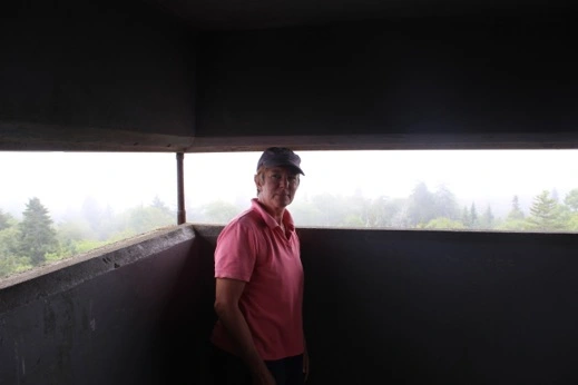
The top of The Tower.
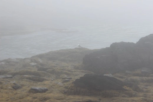
Smugglers Pass at the southern end of the island. A lonely sea gull on the seaweed covered rocks.
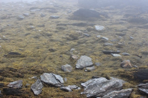
Sea weed amongst the rocks as the tide ebbs.
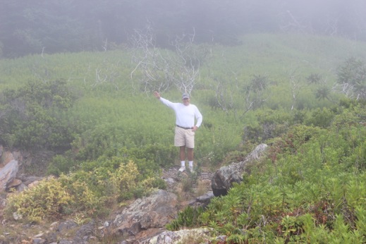
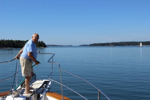
Our Captain marching about.
Jewel Island in the morning light as we haul anchor & head north.
One of the many lobster boats plying the waters: Thousands of lobster pots everywhere!
North end of Jewel Island, ME
Bye Jewel.
Evening light in The Basin.
Day 417 August 5, 2015 Ebenecook Harbor, ME (Southport Island)
43 49 77 N 69 40 69 W (3.7 h) Hodgdon Yacht Services
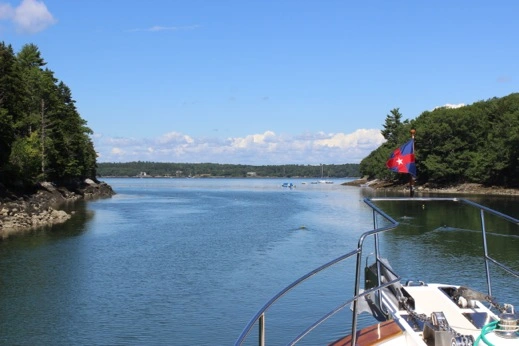
A beautiful calm & sunny morning in The Basin. The group of boats that followed us in yesterday afternoon took off at 0900 at low low tide & one of the sailboats didn’t make it out of the anchorage without leaving some bottom paint behind. I kayaked around the basin and explored the mud flats which surrounded the entire inlet. The sea gulls were picking their breakfast out of the mud and the sea birds were diving in the shallows. So pretty. I went ashore and into the woods and found an old logging/mining road that took me up the hill. At the top of a hill there was an old sign, “mica mine”, so that’s what all the shiny rocks were! Such a beautiful spot. We waited another hour for the tide to come in so we too wouldn’t run aground and didn’t have any trouble getting out — except the bloody lobster pots everywhere. We headed back down the New Meadow River out into Casco Bay. We ducked in behind Sequin Island and worked our way up the coast of Georgetown Island into Sheepscot Bay. We tried to make reservations in Boothbay Harbor but we’re too big for the BBYC moorings and the docks were all full so we went to Southport Island & tied up at Hodgdon’s. We can borrow a car so we’ll head over to the BBYC for dinner. There continue to be squall lines to the West every afternoon but no rain today.
Tide still going out.
A front blew through yesterday evening but this morning it was calm & beautiful. Great for kayaking.
The inlet to The Basin. Tide was flooding and most of the lobster pots were at the other end.
Southport, ME. Afternoon clouds moving in.
This week was less to do with our Big U cruise and more about working & getting ready for Chimney Corners Camp.
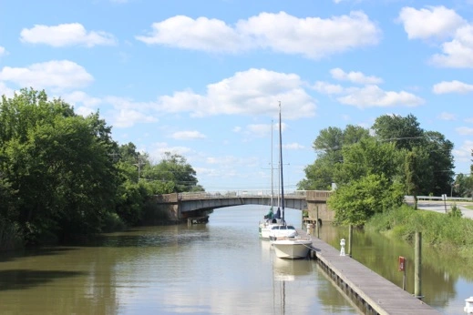
Day 401 July 20, 2015 Layday Padanaram, MA 41 35 20 N 70 56 78 W
Back to Reality — Peter & I had a meeting with Chris Electronics to discuss the Furunos’ issues. Charlotte’s friend Riley came over for a sleepover and it was great to see both Riley & Jayne after so long. Peter got picked up by Cynthia and headed off to Boston to catch an evening flight to LAX. Frances & I enjoyed movie night. The big girls watched a movie on deck & caught up.
Day 402 July 21, 2015 Layday Padanaram, MA
Frances heads off to her first year of camp on Sunday so we went shopping to get her all ready to go. On our way to Route 6 we stopped by Katydid Farm and saw my buddy Tigger. I think he recognized me — certainly liked the peppermint & carrots and walked straight to one of our favorite grazing spots. He looks great and both of us will take it slowly this fall as we get back into shape. Successful camp provisioning day.
Day 403 July 22, 2015 Layday Padanaram, MA
After many discussions decided that the Honda Odyssey is still the best car for our family. Back on the road again. Lots of camp packing going on.
Day 404 July 23, 2015 Layday Padanaram, MA
Frances went to see Lily & Brogan in Westport while Charlotte and I went to Camp Shopping. Both girls had their annual check ups so they are cleared for Camp. New wind indicator installed while we were on the road. Movie night aboard – Duff. Peter due back from LAX late tonight.
Day 405 July 24, 2015 Layday Padanaram, MA
Peter headed into Providence while the girls and I continued to get ready for the departure on Sunday.
Day 406 July 25, 2015 Layday Padanaram, MA
Thank goodness for Honda minivans. The entire trunk area is full of camp gear. Everyone is ready to head West in the morning.
Day 407 July 26, 2015 Layday Padanaram, MA
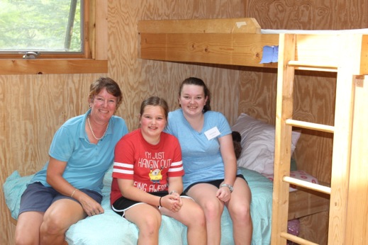
Back on the Mass Pike heading west to Becket, MA and Chimney Corners Camp. Our usual lunch spot had closed so we ended up having a take out lunch and a quick nap before the 1300 drop off. This is Frances’ first year, she’s a Junior, and her cabin is called the Black Pearl. Perfect for her as she is a Jack Sparrow fan. Charlotte is a Senior and is in one of the newer cabins — Galactia. Uneventful trip back and we enjoyed dinner with the people in the Yellow House.
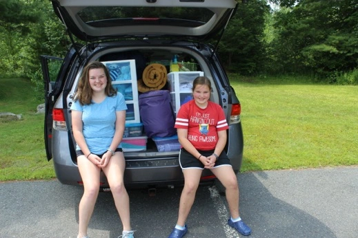
Charlotte & Frances and their camp gear. Frances’ new minion shirt “I’m just hanging out being awesome”. So Frances!
Charlotte’s Senior cabin — scored a great bottom bunk in the corner.
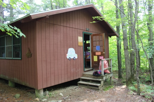
Frances’ cabin – The Black Pearl. One of the older cabins in the Junior unit but all our kids have started out in one of these cabins.
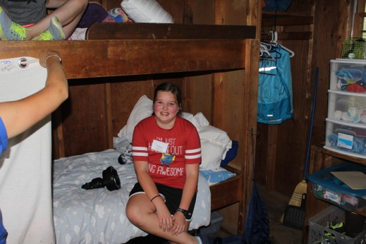
Frances got a bottom bunk too. It was pretty hot in the cabin with 8 girls unpacking stuff and getting settled.
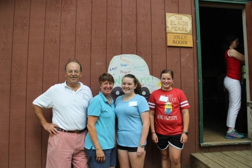
Outside the Black Pearl before we shoved off for Padanaram. They even spelled Frances name right — she was thrilled.
Day 408 July 27, 2015 Layday Padanaram, MA
Provisioning and we hosted the Yellow House for cocktails aboard the M/V Choisi.
It was a busy week as we had re-entry and exiting all within 7 days. Peter’s trip to CA was a success so that was great news. We managed to find everything we needed for camp and it all fit in the trunks and the back of the van. It was wonderful to be on the dock at the Yellow House as we could come and go easily and were able to have friends stop by and visit. All in all a good week but it will be wonderful to be back out on the water tomorrow.
It’s been busy these past couple of weeks & limited internet. Happy Reading!
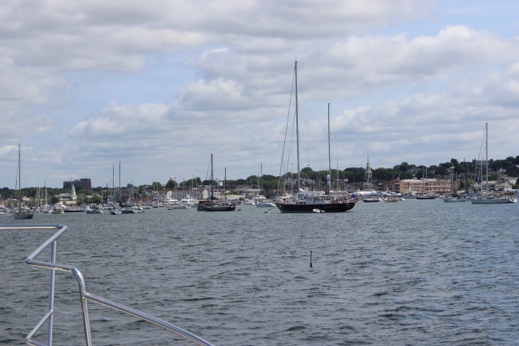
Day 396 July 15, 2015 Newport, RI Layday
We awoke to a sound we haven’t heard in a very long time — a fog horn!
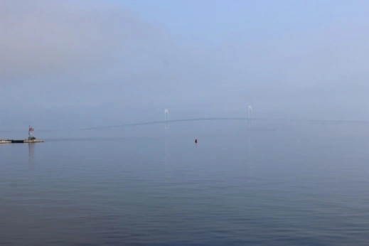
A view of the Newport Bridge off our stern. The red off Fort Adams is to the left. The twin towers of the bridge are above the red nun.
We went to the International Yacht Restoration School to check on the progress of the Coronet – coming along nicely — & Charlotte had Froyo while we enjoyed our first Del’s Lemonade in a year. A tasty treat on a hot day ashore. We had Peter & Kate K. down for dinner in the Bolero Grill before heading back to Choisi.
Day 397 July 16, 2015 Woods Hole, MA 41 31 45 N 70 40 63 W 38 nm/ 5.9 h
The day started off with a BANG. The weather forecast predicted heavy winds last night out of the North and they were correct. After we got back from dinner at the NYYC the wind really started to pick up and by 0230 it was honking and the lines were creaking. Peter & I added an additional line to the mooring and that stopped the squeaking. At 0710 we heard a bang and then felt Choisi start to move. Not a good thing when you’re supposedly attached to a mooring. The line attaching us to the mooring ball had severed about 3 feet from the mooring ball. The other lines and the mooring pennant were still attached to Choisi so there was nothing dragging in the water to foul the prop so we motored towards Newport harbor to get in the lee of the shore. Once I was able to get all the lines and the pick up stick back on deck we anchored in the mooring field in the lee of the north shore. Upon inspection there was a lot of blue paint on the mooring pennant which suggests that someone had run over the line at some point and frayed the line enough so that when the high winds kicked in it just couldn’t hold us. We reattached the pick up stick to the mooring and made arrangements to have the lines replaced. That was exciting.
View of Harbour Court from our anchorage after the mooring popped.
Newport Harbor. Alway busy in July. Still strong winds out of the north.
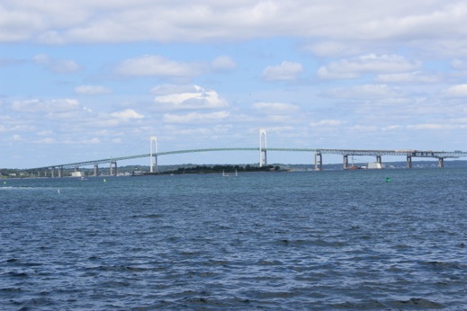
A view of the Newport Bridge on a clear and lovely morning.
At 1030 we hauled up our anchor and headed out of Narragansett Bay towards Martha’s Vineyard. Again the weather guessers predicted heavy Northerly winds for tonight so there are only a few places one can go to be sheltered from a north wind — Woods Hole is one of the best. The additional attraction of Woods Hole is that it has a great breakfast joint. So off to Woods Hole we went. The wind filled in during the afternoon so by the time we hit Woods Hole it was blowing 15 knots out of the north and the tide through Woods Hole was still against us but starting to turn. We picked up a mooring from the WHYC and enjoyed a lovely and dry evening.
The Inn at Castle Hill leaving Newport. The flags show the wind is still honking out of the north.
The lighthouse at Castle Hill.
Woods Hole, MA. Going against the current is always a little tricky in this stretch of water.
View across Wood’s Hole towards Martha’s Vineyard. Evening light.
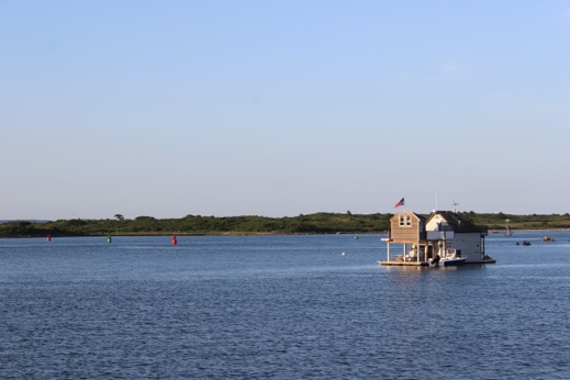
Anchorage at Woods Hole: A few houseboats scattered about.
Day 398 July 17, 2015 Edgartown, MA 41 23 23 N 70 29 88 W 15 nm/ 3 h
We headed ashore to have breakfast at one of our favorite spots by the bridge. Always nice to sit by the window overlooking the little channel leading to the inner harbor. Peter has to head to CA next week so we found a coffee house with internet access and finalized his travel plans. We headed out of the harbor with a favorable tide through Woods Hole and were doing 10 knots across to West Chop. As we turned into Edgartown Bay we encountered tons of 420’s & Optis all racing across the Bay. Crazy. We filled our water tanks at the water buffalo because our generator decided to quit again. So at least we’ll have water. When we shut down the engines we found that the same solenoid that popped out in Shelter Island did it again. Peter taped in down with electrical tape and the system is up and running — a temporary fix for now.
The regatta off Edgartown Beach. A few close encounters by the Optis & 420’s but no one got too close to us.
A view of Edgartown from the anchorage.
Day 399 July 18, 2015 Cuttyhunk, MA 41 23 23 N 70 29 88 W 15 nm/ 3 h
Charlotte decided not to go ashore so Peter, Frances & I went to find a new spot for breakfast as the Inn we had gone to for 16 years no longer serves breakfast on the patio. A disappointment but the proprietress said “hopefully you have some good memories?” We certainly do as we took the children there every year since they were little so lots & lots of great memories sitting under the old trees eating coffee cake & admiring the flowers that tumbled down from the upper deck. We decided to check out the historic Kelly Inn and sat outside and had a great breakfast and happily headed back to the boat to haul anchor and head back towards the mainland.
Going with the current through Quick’s Hole on our way to Cuttyhunk.
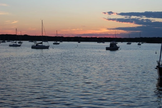
Sunset from Cuttyhunk. We anchored off the north side of the breakwater in our usual spot.
Day 400 July 19, 2015 Padanaram, MA 41 23 23 N 70 29 88 W 15 nm/ 3 h
The last stop on our “breakfast tour” was the Fish Club on Cuttyhunk. We knew we’d have to get there early so we were up and adam quickly and at the Inn by 0815. All the table were already full & there was quite a list but it usually goes pretty quickly so we grabbed coffees and sat by the bluff overlooking Vineyard Sound. For whatever reason the wait was incredible and it took us over 2 hours to have breakfast. The first time it’s ever been so bad but the food was good as always and we went to the corner store and got new Cuttyhunk T-shirts for the girls. A quick run over to Padanaram & back to civilization.
Approaching Padanaram Harbor on Day 400!!
View of Susan’s house at Nonquitt as we approached Padanaram.
The swing bridge in Padanaram. Yellow House just to the left of the pennant.
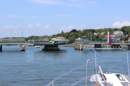
1300 opening on a Sunday afternoon. Lots of bets being taken if we were going to fit through the West side of the bridge.
Day 400 at an end. Sunset off Water Street.
We’re almost to Padanaram but this file is getting too big so I have to post before Leg #21 is completed.
Day 386 July 5, 2015 Glen Cove, NY 40 51 39 N 73 38 73 W 16 nm / 2.5 hr
There wasn’t much to keep us in Flushing, NY so we started East down Long Island. Glen Cove got a good write up in the cruising guide but the town didn’t have much going on (it was the 5th of July) and even the local ice cream store was closed. We stayed at a Brewar’s Yard and after an initial attempt at a slip that only had 17 – 18’ of beam, we ended up on the travel lift dock next to the fuel dock. We did take advantage of the strong water pressure and started getting rid of some of the city grit we picked up in NYC.
Glen Cove Creek — entrance to the Brewar’s Yard. An extreme low tide.
Looking out towards Mosquito Cove after we moved to another dock space in the morning.
Choisi at Glen Cove. The water stain on the bow returned after our trip down the Hudson River.
Frances wanted one of these for her birthday!
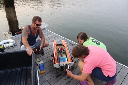
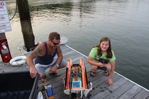
Michael and his home made speed boat that he races up Glen Cove Creek at 70 mph. The brass prop is very sharp.
Choisi: Evening light on Glen Cove Creek
Day 387 July 6, 2015 Oyster Bay, NY 40 52 82 N 73 31 90 W 15 nm / 2 h
When we cruised LI Sound with the NYYC in 2001 we stopped in Oyster Bay and were guests at the Seawanhaka Corinthian YC. Unfortunately we don’t have reciprocity with the Club (and the dining room was closed) so we anchored off town south of Centre Island. We launched Plover and headed in to check out town. The girls took advantage of the newly constructed playground at the Teddy Roosevelt park while Peter & I found a paper and a new fly swatter. President Roosevelt’s summer home was on the top of Sagamore Hill on Cove Neck just outside of town.
Sagamore Yacht Club & Oyster Bay Marine Center.
Town beach at Roosevelt Park.
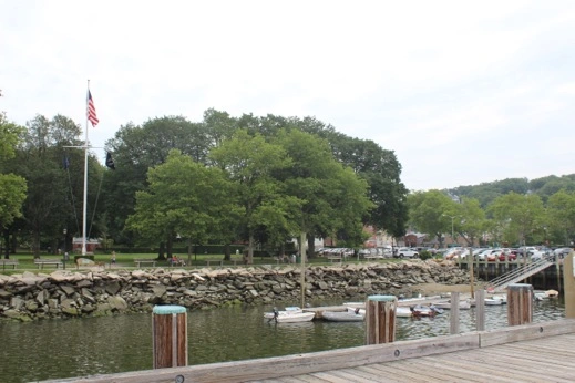
Day 388 July 7, 2015 Northport, NY 40 54 04 N 73 21 22 W 16 nm/ 2.3 h
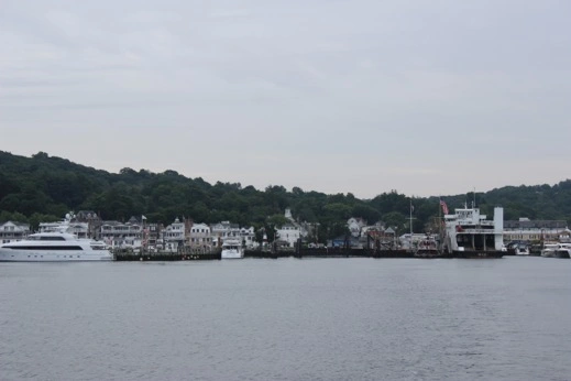
We continued poking along the north shore of LI and went into Northport Harbor. We tied up at the town dock at low tide (again) and registered 1’ under our keel. Behind us was a 35’ trawler from Staten Island who’s owner we chatted with while we were there last week. It’s a small world on the water some times. Northport was a find. A great little town built right down by the water full of great shops & restaurants. We found an old soda fountain shop with home made ice cream that looked like it was frozen in time. The store owner recommended the Main Street Cafe for dinner (next door) so Peter & I had a nice dinner at a table by the front window. The next morning we went across the street to the Pullman Car Diner and had breakfast in an old railroad car that had been converted into a diner — great space. Three for three.
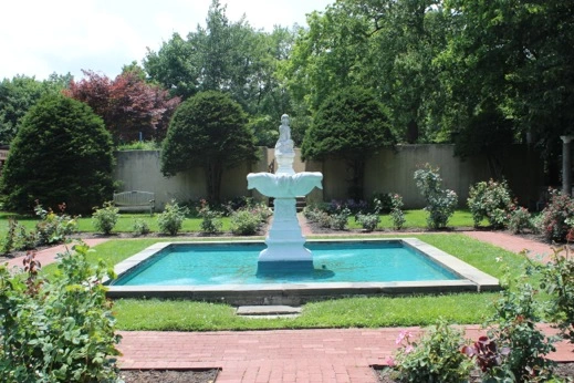
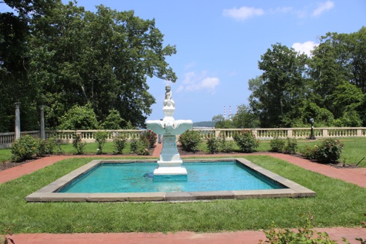
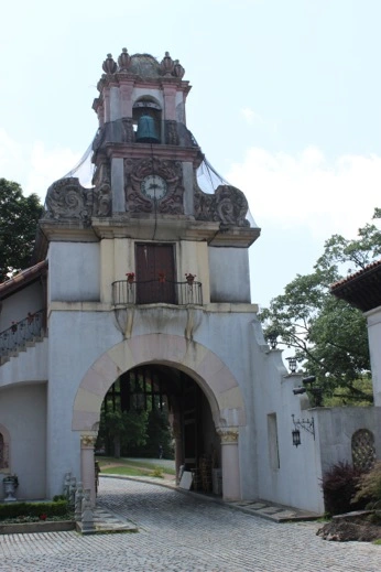
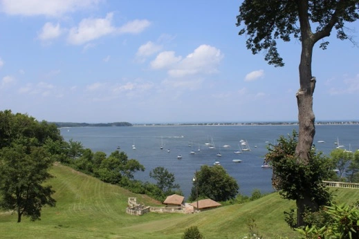
One of the reasons I wanted to stop here was to check out the Vanderbilt Museum & Planetarium. “Eagle’s Nest” is a 24 room Spanish – Revival mansion sitting on 43 acres overlooking Northport Bay. The home was originally built for Wm K. Vanderbilt in the 1930’s. It’s been open to the public since 1947 after the second Mrs. Vanderbilt died. The mansion & museum space houses Vanderbilt’s collection of rare birds, fish, plants and specimens collected on his round the world voyages aboard his 250’ M/V Alva. The collections of specimens and sheer number of artifacts from around the world is incredible.
The waterfront park at the Town Dock.
Looking north down the channel into Northport.
Low tide in Northport, NY
The fountain by the planetarium at the Vanderbilt Mansion
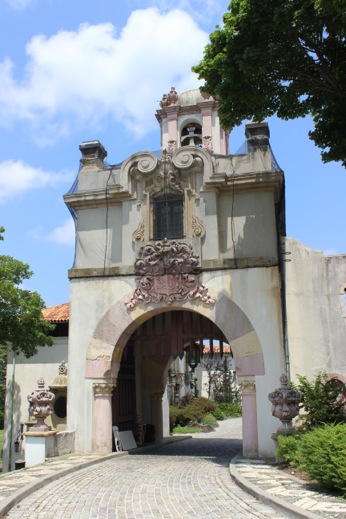
The gated entrance to Vanderbilt’s house. It’s getting a little “tuck pointing”.
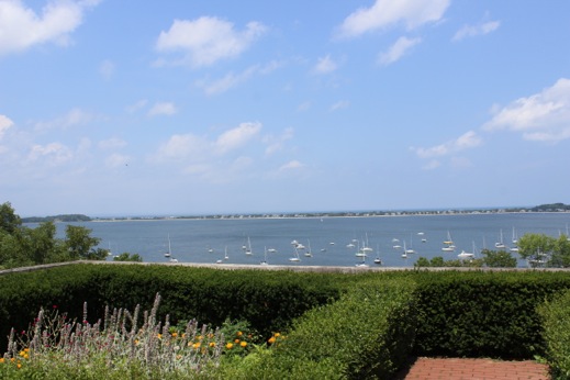
View of Northport Bay from the Vanderbilt Mansion.
The clock tower from the inner court yard at Vanderbilt Mansion
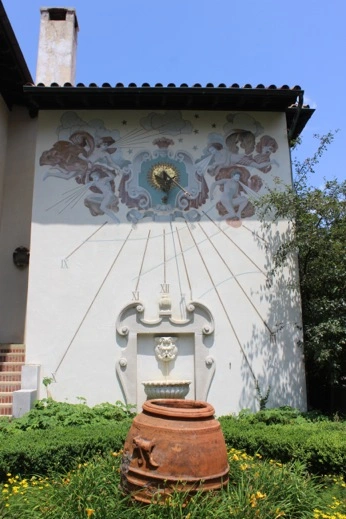
The sundial in one of the smaller gardens.
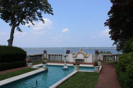
The reflecting pool outside the dining room at the Vanderbilt Mansion
The view down the lawn towards the pool and changing houses. Frances said the pool wasn’t as nice as the one at Hearst Castle!
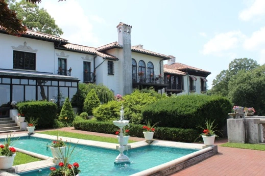
The Vanderbilt Mansion. The original part of the house is one the right. The addition is off to the left.
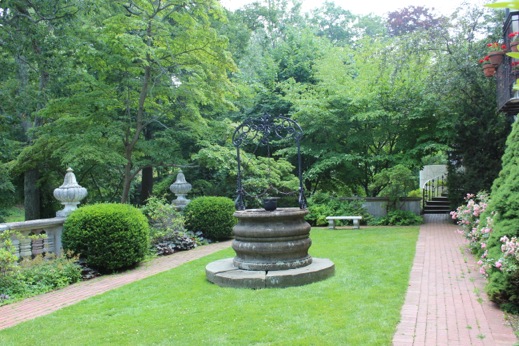
Another side garden with an old well.
Day 389 July 8, 2015 Port Jefferson, NY 40 56 86 N 73 04 23 W 23 nm / 3.3 h
We need to provision so we pulled into Port Jefferson as there won’t be any major ports before we get to Newport, RI. It was a cloudy day and the wind was right out of the NE as we headed out. The seas were probably the biggest seas we’ve had since we came north from Turks & Caicos! We actually took water over the bow and got spray on the windshield. We opted to go to Port Jefferson Town marina ($2.60/ft) vs. Danford’s Hotel & Marina ($4.75/ft) and got a good spot tucked in by the ferry dock. We took a cab to the grocery store and got some basic just before the skies opened up and it poured. Charlotte & I went to Starbucks to download a birthday gift for Frances and we dodged rain drops on our way back to the boat.
Port Jefferson: Town dock on the right (we filled the empty spot) — Danford’s to the left of the ferry terminal.
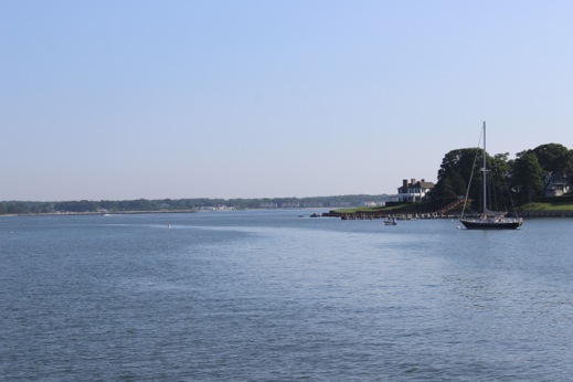
Day 390 July 9, 2015 Coecles Harbor, NY 41 04 03 N 72 17 47 W 51 nm/ 6.8 h
Years ago when I still had my Freedom 35’, the Barrington Yacht Club cruised LI sound. We stopped in Coecles Harbor and it was one of my favorite spots. This time around we didn’t have any issues getting in as the channel was recently dredged and well marked. It’s a great protected harbor and having the sun out made it all the better.
Coecles Harbor shore line: Protected by the Nature Conservancy Foundation.
Coecles Harbor: View to the W/NW.
Morning kayak into the marsh
Receding tide: Coecles Harbor
Frances & I went on a beach walk to Sungic Point: Shelter Island. The sea gulls were huge!
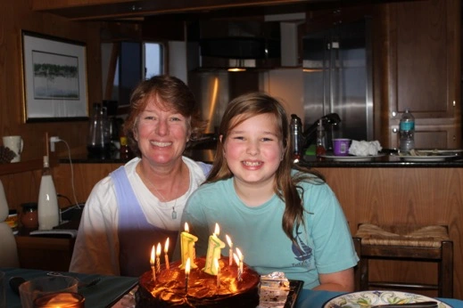
Frances’ 11th birthday. The only crew member who celebrates two birthdays aboard during our Adventure.
Day 391 July 10, 2015 Dering Harbor, NY 41 05 40 N 72 20 93 W 8 nm/ 1.3 h
It was a quick motor around Hay Beach Point and into Dering Harbor. We called the Shelter Island YC and picked up one of their moorings at the edge of their mooring field. The cruising guide said there’s “no anchoring allowed in the harbor”. We later discovered a small mooring field just off our stern – just a heads up if you prefer to anchor. When we brought our J boat to Dering Harbor in 2001 it was the hottest day on record (or if it wasn’t a record it sure should have been). We had motored into Dering Harbor without a breath of wind and it was the hottest day of our cruise. We took Will & Katie ashore and found the local pharmacy which had an old fashioned soda fountain and air conditioning. I think we stayed there for a couple of hours just to cool down. Today it was a beautiful summer day, again no breeze, but a nice day to explore and show Charlotte & Frances the soda fountain. Peter & I had a lovely dinner on the porch at the SIYC and enjoyed the fact that the sun was setting around 2100. A pretty night on the water.
View north towards Greenport from Dering Harbor. Nice “little” house on the point.
Dering Harbor — Shelter Island Yacht Club.
Day 392 July 11, 2015 Dering Harbor to West Neck Harbor to Dering Harbor, NY 41 05 40 N 72 20 93 W 16 nm/ 2.2 h
To get to West Neck Harbor we headed around the west side of Shelter Island through Shelter Island Sound to West Neck. The harbor is a little tricky to get into because of a shoal at the mouth so we had to put off leaving Dering until the tide came up. While we were waiting for the tide Peter & I biked into town for a paper and settle up at the YC. We motored past the barge set up for the fireworks tonight and headed into West Neck. It was a busy saturday in the harbor and boats were rafted up – one 5 across. We anchored just outside the mooring field since it was so crowded and the girls and I headed in to shell beach. Upon our return we found out the marine patrol said we had to move so we headed back to Dering Harbor. At 2130 the fireworks started and we could see them over the trees behind the YC. Since we didn’t see any fireworks on the 4th of July it was fun to sit on the bow & watch the sky show.
As we were shutting down the engines after picking up the mooring in Dering Harbor the generator quit again. We suspect the same issue that caused the previous 2 failures (faulty diode) so we’ll head across the Sound tomorrow to Noank where there’s a Northern Lights mechanic and hopefully they’ll have a replacement part.
View of Shelter Island Sound on the south side of Shelter Island. Shell Beach.
West End Harbor on a busy Saturday afternoon.
Back in Dering Harbor on mooring #121. The fireworks came up right above the tree line.
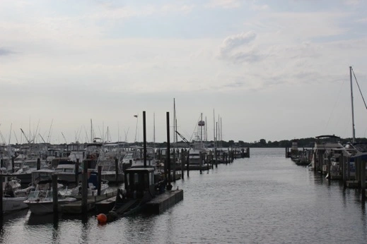
Day 393 July 12, 2015 Noank, CT 41 19 13 N 71 59 29 W 22 nm/ 3.5 h
Peter & I headed back into town for breakfast & to settle up with the SIYC again. We headed East and up through Plum Cut where we caught a nice lift out of Long Island Sound. It was busy out on the water for a change and as the afternoon breeze filled in the sailboats looked like they were having a great time. We pulled into Noank Shipyard & Seaport Marina and tide up at the south end of the fuel dock. Since it was Sunday we couldn’t do anything about the generator so we took a bike ride into town & then took advantage of their internet lounge. We had a quiet night aboard & watched the Kingsmen — not what we were expecting.
The mooring field in Noank, CT. A nice spot just entering or leaving Long Island Sound.
Noank Harbor & Shipyard.
Day 394 July 13, 2015 Bristol Highlands, RI 41 41 74 N 71 17 68 W 46 nm/ 5.7 h
The good news was that the only thing wrong with the generator was that one of the four solenoids had popped out. Again a vibration issue which we will have to address. The mechanic recommended adding some adhesive foam around that part of the generator housing so reduce the amount of vibration in the control panel. So a relatively quick fix which is a nice change for us.
We decided to head up Narragansett Bay to Bristol to see our old friends David & Lisbeth who we haven’t seen in over a year. It will be fun to be in our old stomping grounds. Peter & I used to race our J boat here and have great memories of the first time we put up our HUGE drifter. The wind filled the sail and BANG we took off up the Bay. That was a great sail. We anchored off the Bristol Highlands which is part of the association David & Lisbeth belong to. We took Plover in to their dock and went up the hill to meet their new dog Inky. We left the girls at their house with internet access and went to Warren, RI and enjoyed dinner by the Barrington River. A great spot to anchor if there isn’t too much wind.
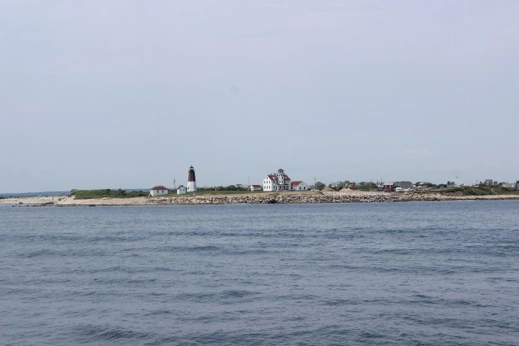
Point Judith lighthouse. We’re back to the land of New England Lighthouses!
Poppasquash Point Park – Bristol, RI. Where I use to race on Tuesday nights from the BYC.
Bristol Highlands: Association dock & grilling pavilion.
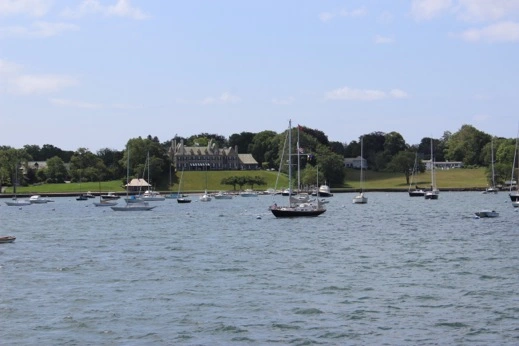
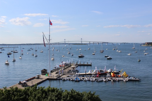
Day 395 July 14, 2015 Newport, RI 41 28 68 N 71 19 99 W 14 nm/ 2.1 h
We went ashore to have coffee with David before he headed into work & borrowed Lisbeth’s car to provision for the next week — much easier here with a car than in Newport. Frances was happy to play with Inky and have some computer time on the couch. We pulled up the anchor and puttered down the Bay on a beautiful sunny and calm day. We picked up Jeffrey’s mooring off Fort Adams which was a nice treat for us. We hailed Navette and headed into Harbour Court to check in for the Summer Cruise & have a Corona overlooking the Newport Bridge. A light rain came in so we tucked in under the awning and waited for a break in the weather to head out to Choisi.
The view a month ago when we were here for Betty’s party. A little cloudy today but we know its potential!
Back in New England Waters:
Day 377 June 26, 2015 Rock Hall, MD 39 07 98 N 76 14 65 W 16 nm / 2.7 hr
We’re back on the water heading north up the Chesapeake Bay.
The inner harbor at Back Creek, Annapolis
Heading out into the Chesapeake Bay.
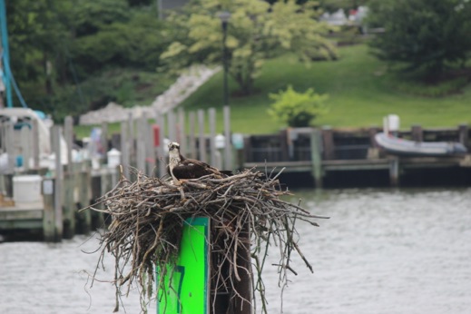
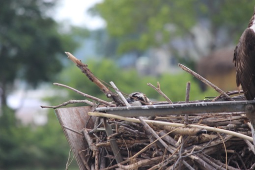
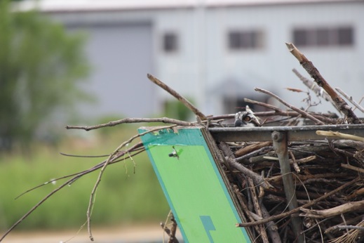
Frances got a great shot of a baby osprey off Annapolis, MD.
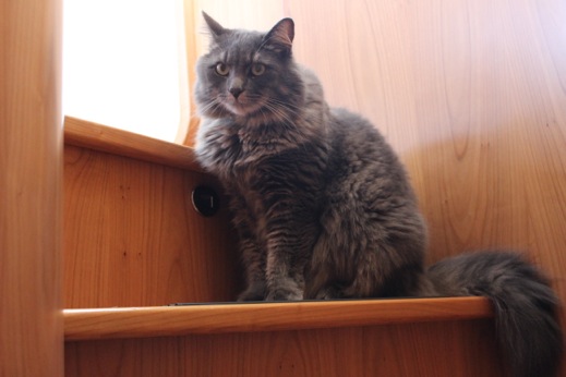
Leo thought the top step was a good place to sit — not really dude.
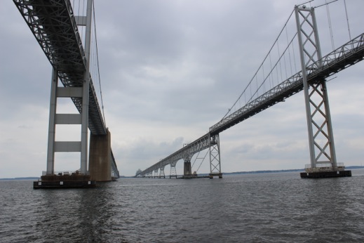
Toll bridge over the Chesapeake Bay
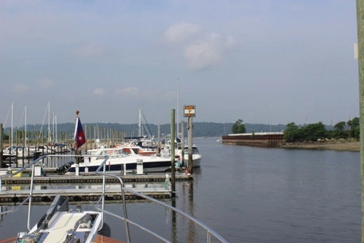
Choisi: Rock Hall Maryland. Rock Hall Landing Marina
Looking south down the Bay
Evening light Rock Hall harbor.
Day 378 June 27, 2015 Delaware City, DE 39 34 26 N 75 35 42 W 57 nm / 7.2 hr
Rainy & windy day to make the passage of the Chesapeake & Delaware Canal. We shoved off from Rock Hall and headed north to time our passage with the favorable tide. We didn’t pass a single commercial boat/tug & only saw 2 power boats in the canal — very quiet from what the cruising guide suggested. One of the boats we passed called us on the radio to report there were 6’ seas on the Delaware River side. We thought about turning back but pushed on and didn’t find anything that remotely looked like a 6’ wave – more like 2 foot chop. So we didn’t have any issues getting into the marina in the pouring rain & were happy we continued on.
Rainy, chilly passage through the C & D canal.
Day 379 June 28, 2015 Layday Delaware City, DE
The weather report suggest strong winds out of the S/SE so we’ll hang here and let the end of the front move through. We took a ferry across the river to Fort Delaware which was built on Pea Patch Island in between Delaware & New Jersey. The fort was completed in 1861 and served as a Civil War prison which held over 32,000 Confederates. It is a living history museum which means the guides are in costume and re enacting a day in 1864.
Delaware City Marina. The marina is in the old canal which they moved to the current location in 1927.
The original canal in the center of town was 60’ wide and 10’ deep. The canal was dug by hand and linked Baltimore & Philadelphia. It saved a 300 mile trip down the Atlantic Ocean and back up the Chesapeake Bay from Norfolk, VA.
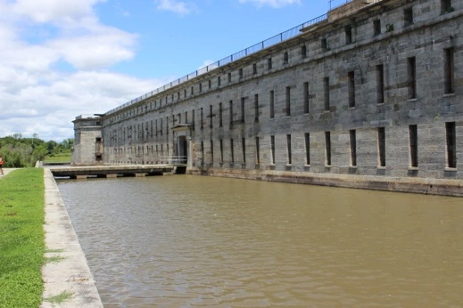
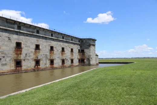
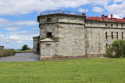
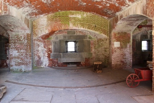
Fort Delaware. The first real water moat we’ve seen.
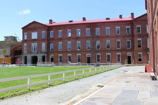
Enlistedmens’ barracks in Fort Delaware
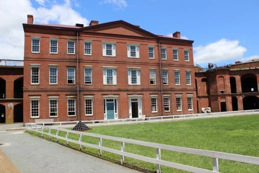
Officers Quarters: Fort Delaware
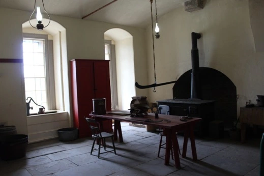
Kitchen: enlisted men’s quarters. The men worked in shifts & were responsible for their own meals & rations. The rations were weighed out by the scale hanging over the table.
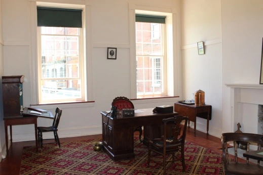
The General’s office: Fort Delaware
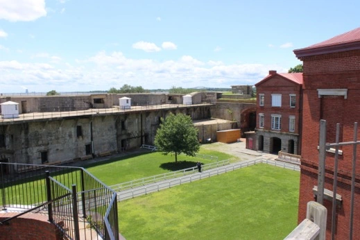
View of the Parade Grounds from the ramparts
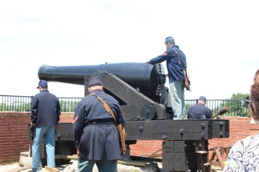
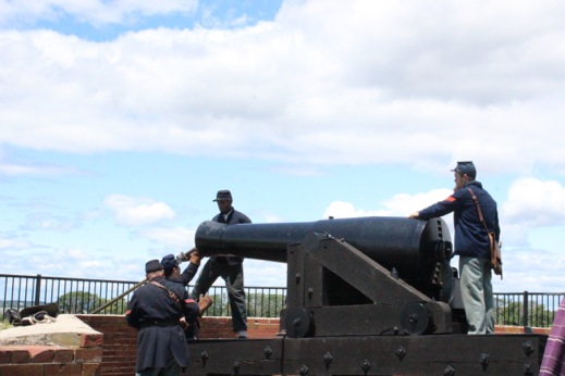
8 – inch Columbiad Demonstration: 5 men — 40 seconds for each reload and firing.
One of the lower gun ports.
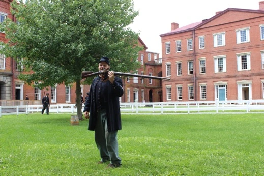
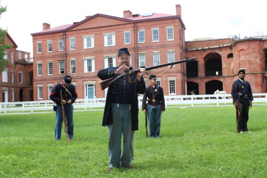
Musketry demonstration. Frances identified it as a “Brown Bess” which she read about in My Brother Sam is Dead.
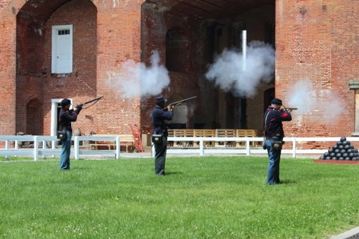
Artillery demonstation.
One of the 50 prison barracks (only 1 replica) that housed 200 Confederates during the war
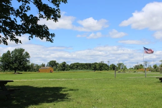
Pea Patch Island. Most of the current island is made of fill from dredging the canal. The north end of the island is the largest heronry north of Florida, where thousands of herons & egrets nest each year.
A blue heron in the canal by the dock while we enjoyed our morning coffee on the back porch.
Day 380 June 29, 2015 Cape May, NJ 38 57 08 N 74 54 38 W 53 nm / 6.7 hr
Today we passed the 11,000 nm mark — so far we’ve travelled 11,000 nm from Juneau, AK to Delaware City, DE.
Delaware City Marina — morning light the day we shoved off. Pretty spot.
The old hotel in Delaware City that use to sit right by the edge of the original C & D canal.
The water front in Delaware City, DE.
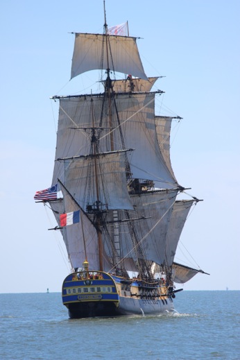
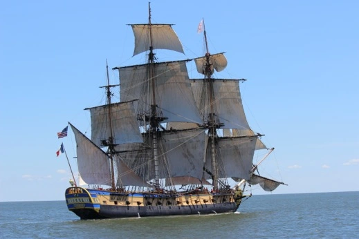
L’Hermione — the replica of the French schooner (seen in Annapolis) which came to the Revolutionaries aid during the War.
Utsch’s Marina — Cape May, NJ. Slip #1 — straight shot in.
Day 381 June 30, 2015 Barnegat Bay, NJ 39 45 14 N 74 10 53 W 74 nm / 9.3 hr
We tried to go out to dinner last night but there was a 45 minute wait and tons of people loitering around the parking lot so we opted to grab some chowder & some salmon and cook onboard. When we were checking in yesterday the dock master recommended Schooners for breakfast so we had breakfast at the counter and reminisced about Dan’s Wigwam in Warren, RI where we use to take Will & Kate years ago. Both are good old fashioned American diners.
Our initial plan was to head north 40 nm to Little Egg Inlet (one of the few inlets recommended in the guide book). But when we got there there were rollers breaking & we couldn’t really make out where the channel was. Peter hailed a tug boat who looked like he might be going in but he was heading further south. He said it was really tricky to get in and much better to keep going north and head into Barnegat Bay — still tricky but a better approach with deeper water. So we kept going.
The channel entrance at Barnegat — rough but much better than Little Egg Harbor which had shoals, skinny water and shifting buoys.
Inside at Barnegat Bay. Just north of the inlet to the Bay was mile marker #25 for the ICW.
Day 382 July 1, 2015 Staten Island, NJ 40 32 58 N 74 08 35 W 63 nm / 8.4 hr
It poured last night but the scoop anchor held firm. We shoved off early to catch the high tide as there were a few places where the water got pretty thin on our approach.
Marshes leaving Barnegat Bay: High tide.
Lighthouse: Barnegat Bay, NJ
Atlantis Marina & Yacht Club. Staten Island NY
Mooring field at Staten Island marina
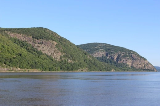
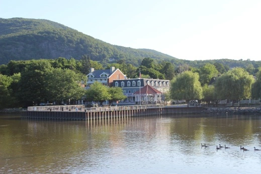
Day 383 July 2, 2015 Cold Spring, NY 41 24 88 N 73 57 72 W 63 nm / 7.4 hr
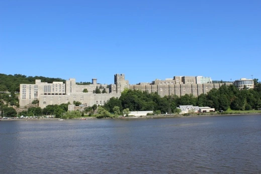
We headed up the Hudson River to check out West Point and the Hudson River Valley which painters have captured on canvas for generations.
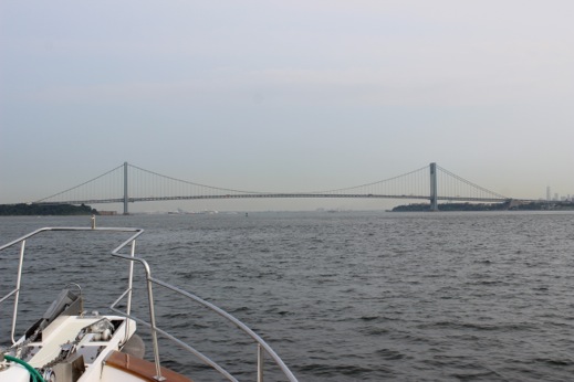
Approaching NYC via the Verazano Narrows Bridge — New World Trade Ctr on the right.
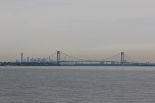
NYC skyline from the Veranzano Bridge
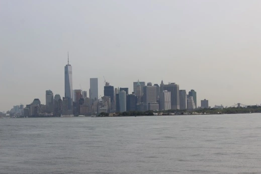
New York City.
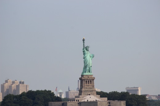
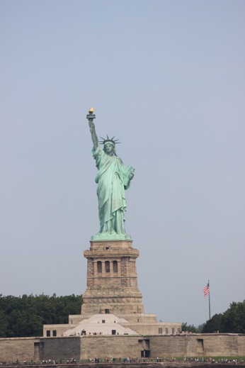
Statue of Liberty
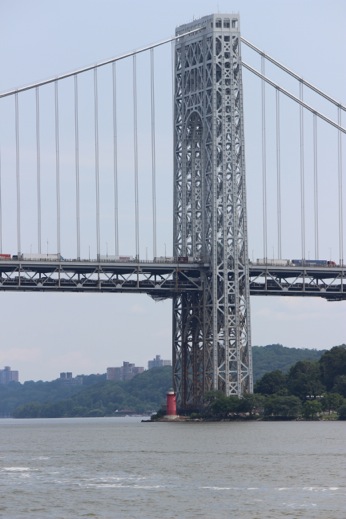
George Washington Bridge
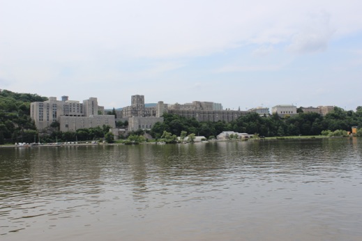
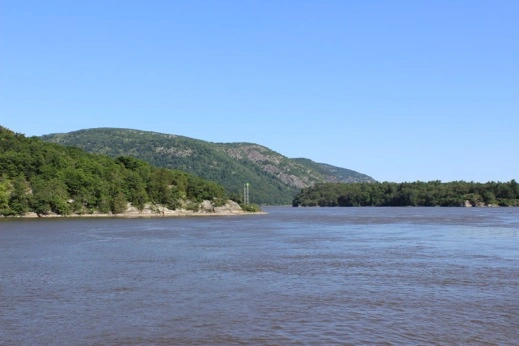
West Point, NY
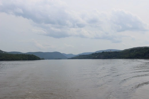
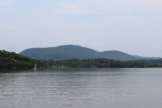
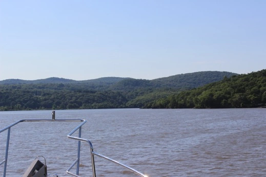
Hudson River Valley
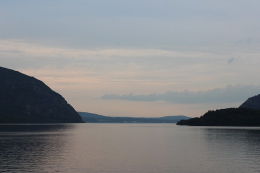
Anchorage off Cold Spring, NY. Evening light looking north.
It was a pretty trip up the Hudson River. We cruised by Manhatten and then up the river to West Point. We anchored north of the campus off the town of Cold Spring, NY. We launched the dingy and went to check out town. We found Moo Moo’s Ice Cream and walked up the hill into town. We had to go through a tunnel under the railroad tracks — Amtrak service in and out of NYC. A nice little town; reminded us of Hudson, NY. We cleaned off the remains of the ICW water stains off the bow so now our girl is clean & pretty again. A pretty night at anchor and it was nice to sit out in the chair swing on the top deck.
Day 384 July 3, 2015 Weehawken, NJ 40 45 57 N 74 01 11 W 43 nm / 5.7 hr
Hudson River: morning light
Riverfront Cold Spring, NY
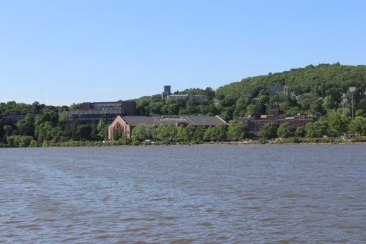
West Point Campus: Beat Air Force is spelled out on the roof of the gym.
West Point Campus: morning light
A beautiful clear & crisp morning. The sun’s out and the mountains are so pretty all around us (our first mountains since the DR). There were more pleasure boats on the Hudson today but still quite of few barges & tugs heading north.
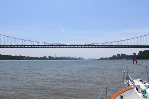
Approach to NYC under the George Washington Bridge
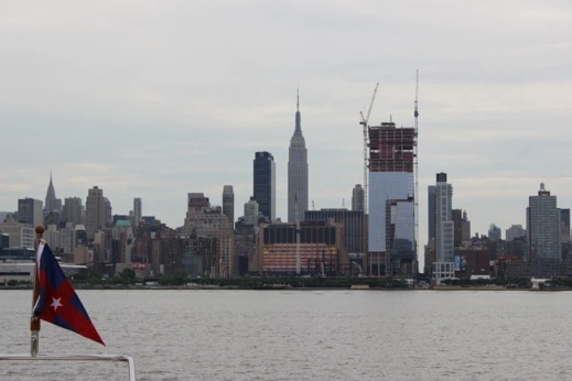
View of the Empire State Building from Lincoln Harbor YC — across the Hudson in NJ.
NYC & Intrepid Space Museum — the new structure on the flight deck of the aircraft carrier now houses one of the Space Shuttles.
World Trade Center from NJ.
We got settled and decided to take our bikes into NYC and bike to Central Park. We caught the NY Waterways ferry across the Hudson and found a great bike path that runs along the river. We biked north to 67th street and then east to the Park. The park was full of tourists and New Yorkers who were taking advantage of a beautiful sunny day in the park. We biked back south and had dinner before catching the ferry back to NJ. Another new experience in New York City.
Day 385 July 4, 2015 Flushing Bay, NY 40 45 58 N 73 51 07 W 17 nm / 2.3 hr
The East Branch started flooding at 0700 so we got underway at 0900 and headed down the Hudson & up the East River arriving at Hell’s Gate at 1030. We had the engines set at 1550 RPMs and were still doing 12.8 knots through Hell’s Gate. It reminded us of our trip through the narrows up at Dent in Alaska. Another wild ride.
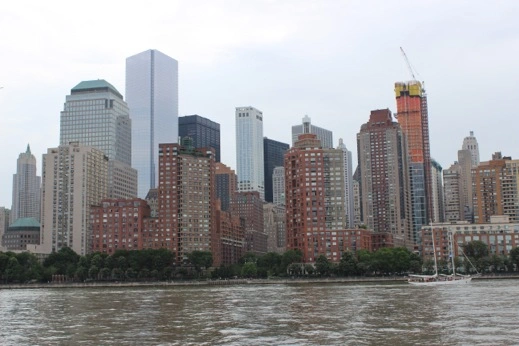
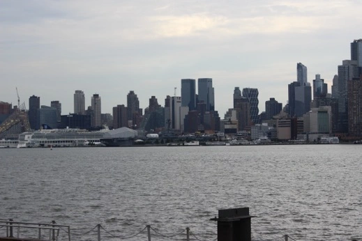
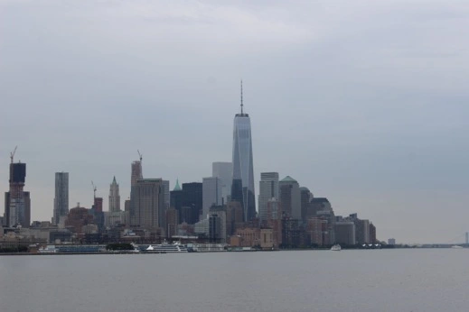
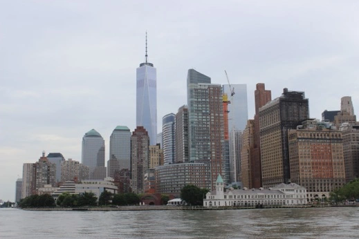
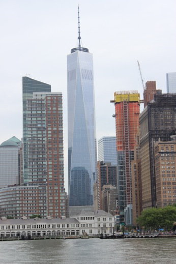
The south end of Manhatten.
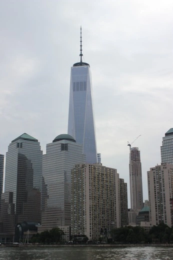
The new World Trade Center — 1776’ tall.
The Battery
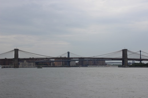
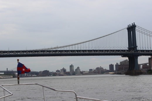
The Brooklyn & Manhatten Bridges
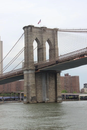
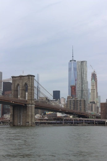
Brooklyn Bridge
World Trade Center & Manhatten Bridge
We made it up and around Rikers Island and made our way into Flushing Bay where we tied up at World’s Fair Marina. Peter & I took our bikes past Citi Field to Flushing NY where we found a Target to get provisions and supplies for someone’s birthday in five days.
